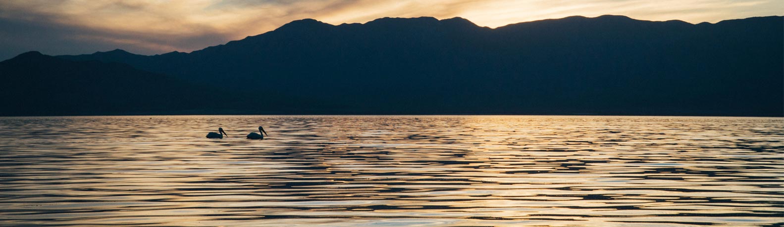

Khoton lake is fed by more than 10 rivers and streams which fed by snow and ice water such as Black Khovd, White Khovd, Chuluut (Rocky) and Zagastai (Fishy) drain the 2670 square km area of Altai Tavan Bogd and Rashaan mountain range. The lake has an island, 0.5 square km, with forest, bushy trees, and glacial thick sediments from the quaternary era mostly sand, clay and break-stone covered the bottom of Khoton Lake. Along lakeshore, there is forest and bushy trees as well as some migrating birds are seen. The lake is home to many species of fish
The Khoton and Khurgan lakes are second largest and clearest of all lakes in Mongolia. The average depth is 26 m, the maximum depth is approximately 58 metres.
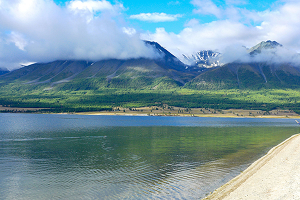
The landscape around the lakes is stunning: with forests and the snow-capped Altai Mountains. Khoton and Khurgan lakes are home to the grayling (thymallus arcticus) and the lenok (brachymystax lenok). The lakes are located in an intermontane tectonic depression in the northern portion of the Mongolian Altai Region. The lakes themselves, as well as the mountain rivers which feed the lakes, offer excellent sport fishing in a rugged and virtually unpopulated area.
Surface area is 50.1 km2; the average depth is 26.6 m; the maximum depth is approximately 58 m. Khoton lake has one Iceland which is covered by woods. The system of Khoton and Khurgan lakes, connected by a wide channel, is the source of the Khovd river which drains the whole Mongolian Altai. Lake Khoton was formed by glacial blockages. Khurgan nuur is the lowest point of Altai Tavan Bogd National park.
Recommended

Mongolian winter is the most incredible winter that one might experience and there is plenty to see and enjoy during a winter travel. Glittering white snow, clear fresh air, sun, and little chills are the image of Mongolian winter. Taking this fan...
Duration: 3 Days / 2 Nights
Destination: Gobi - Central
All of Mongolians celebrate the Lunar New Year, which is called in Mongolia “Tsagaan Sar” or the “White Moon”. It is widely celebrated throughout the country around January or February according to the combination of Solar-...
Duration: 3 Days / 2 Nights
Destination: Gobi - Central
# Room 22, Building 31, Songino-Khairkhan district, Ulaanbaatar Mongolia
info@toursofmongolia.com
sales@toursofmongolia.com


